Utrecht’s Oudegracht is best read in two layers. There is the busy street above, and below it the wharf beside the water, with cellar doors that hint at an older working city. You can appreciate that arrangement without descending every staircase—or treating the canal as a corridor to hurry through.
Make this a short, adaptable walk. A few careful pauses reveal more than a long route completed in wet shoes, and staying at street level is a worthwhile visit in its own right.
See a trading system, not just a waterside terrace
Discover Utrecht explains that the medieval wharves and cellars developed through private initiative, supporting the movement and storage of goods. The lower level was practical infrastructure, not originally a scenic extra for visitors.
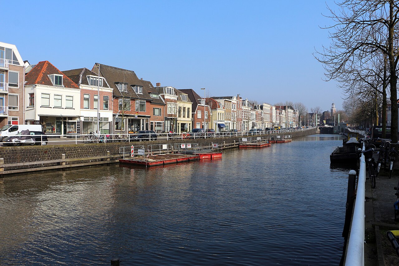
From a safe public viewpoint, look across the water at the relationship between the upper street, the lower wharf and the cellar entrances. Notice how the levels connect and where a bridge interrupts the view. There is no need to enter a cellar to understand the basic pattern.
Some spaces now have different uses, but a visible door is not an invitation. Respect private premises, working businesses and anyone using the wharf for access. Keep stairs and entrances clear when stopping to look or take photographs.
Take a small section of the official walk
The tourism board’s complete Canals and wharf cellars walk is listed as three kilometres, with eight locations. Our suggestion is a shorter editorial adaptation, not a claim that the full route is open, step-free or achievable in a fixed time.
- Start at Domplein. The tourist information centre is at number 9; ask about current canal works and a suitable route if access needs affect your visit.
- Follow Servetstraat towards Oudegracht. Pause at street level to understand the waterway before deciding whether to extend the outing.
- Choose the short canal section towards Stadhuisbrug. The city hall is a useful exterior landmark. Follow signed diversions and keep the option to turn back rather than force a continuous waterfront line.
- Stop when you have seen enough. A return towards Domplein, a confirmed café stop or an earlier finish are all valid conclusions. Lower-wharf access is optional, not a requirement.
October works matter more than an old route map
22 October check: Utrecht’s municipality lists restoration of the wall and wharf between Bezembrug and Stadhuisbrug, on the Winkel van Sinkel side, for October 2026 to April 2027. Do not build this outing around uninterrupted access to that lower section.
Consult the specific municipal project page and obey the barriers and signs actually in place. A tourism route describes what connects geographically; it does not override construction restrictions. If a stretch is blocked, shorten the walk or use a clearly signed public alternative.
Do not infer that every other section is open because this is the named project, or that an old photograph shows the present arrangement. Local works can change, and a business remaining open does not establish a step-free approach to it.
Decide about the lower wharf before taking the stairs
At any possible descent, check both the way down and how you will return to street level. Consider the surface, handrails, available space and whether the route is actually open. Do not assume another staircase or accessible exit is waiting around the next bend.
- Prefer street level if steps, wet surfaces, limited mobility or carrying a pushchair would make a descent difficult. You can still see how the two levels fit together.
- Allow passing room. Do not make other pedestrians move towards the water while you stop for a photograph.
- Check specific access needs. Ask about entrances and toilets at an intended indoor stop rather than treating the whole historic district as uniformly accessible.
- Keep the water’s edge in view. Concentrate on your footing instead of walking while looking at a phone or camera.
Let the autumn conditions set the length
Check the KNMI warnings for Utrecht before travelling and use current local conditions when choosing the walk. Wet paving, fallen leaves and shorter daylight are reasons to leave extra margin, not to speed up the last section.
A booked indoor visit can be a separate plan, but not an assumed rescue if weather deteriorates. The Dom Tower and DOMunder have their own ticketing and access arrangements; check the operator before adding either. This canal walk does not include a tower climb, boat trip or underground tour.
For a different city-scale pause, try our Aarhus café-day inspiration, or browse more Europe stories. The common idea is to leave enough time to notice where you are.
Sources and photograph
Editorial checks: 22 October 2026. Sources: Discover Utrecht’s canal route; regional route description; municipal wharf restoration project; municipal traffic updates; KNMI and attraction operators linked above. Our shortened route is an editorial suggestion, not a guided booking or access guarantee.
Featured photograph: Oudegracht, Utrecht, Sailko, 11 March 2016, CC BY 3.0. Resized; responsive crops may be displayed. Archival photograph, not current wharf access, construction or autumn conditions.