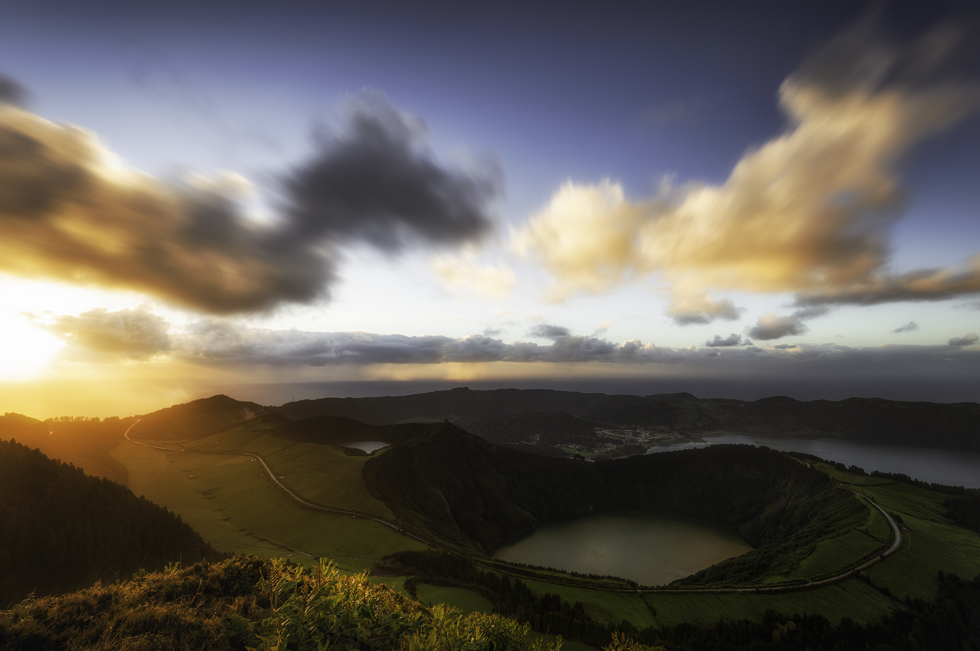
On São Miguel, a promising icon can sit beside rain on the forecast, and a clear coast can coexist with cloud on the crater rim. The answer is not to drive faster between famous viewpoints. It is to plan by island sector, check official information and keep a satisfying lower-commitment option nearby.
Check two things before breakfast
First, read the Portuguese weather service forecast and warnings for the Azores, paying attention to wind and precipitation as well as the general symbol. Second, check the official Azores Trails alerts page. A trail that looked suitable when the trip was booked may be closed or under maintenance on the day.
Forecasts are guidance, not proof of what a particular ridge will look like at 10:30. Use them to choose the safer and more promising part of the island, then reassess from the ground.
The sector rule: choose west, centre or east for the day. Give that area time before crossing the island in search of a patch of blue.
Build the day around one anchor
In the west, the anchor might be Sete Cidades. Pair one principal viewpoint with a village or lakeside stop and a short walk that is officially open. In the centre, Lagoa do Fogo can be the weather-dependent highlight, supported by lower-elevation stops. In the east, Furnas and Nordeste provide a different mix of geothermal landscapes, gardens, coast and forest.
Do not stack three crater viewpoints as if they were appointments. Cloud may clear if you wait; it may also thicken. Give the anchor a reasonable window, then move to the backup without treating the change as failure.
Match the backup to the same area
- West: a village stop, a sheltered coastal lookout or an easy lakeside section.
- Centre: Ponta Delgada’s streets and market, a museum or a lower coastal route.
- East: Furnas village, an interpretation stop or a carefully chosen garden visit.
Opening hours and access rules can change, so verify the chosen indoor or managed attraction before setting out. A backup is useful only if it is actually open and reachable.
Treat trail status as a decision, not a suggestion
If the official trail service lists a closure, choose another route. Do not interpret the absence of a barrier or the presence of other walkers as permission. On an open route, turn back if wind, visibility, surface water or your own footing makes the walk uncomfortable.
Carry a waterproof layer, a warm layer, water and shoes with reliable grip even for a short walk. Keep a dry change in the car. On narrow roads, reduce speed for mist and wet surfaces rather than trying to preserve an itinerary minute by minute.
Use viewpoints slowly
A viewpoint is not a drive-through photograph. Park only where permitted, leave access clear and wait long enough to notice the landscape beyond the first frame. If visibility is poor, resist standing in traffic or crossing a barrier for a marginally better angle.
Weather buffers are a form of good travel design. The same idea underpins our Greek island-hopping plan: protect the essential part, simplify the sequence and let conditions shape the rest.
São Miguel is not one postcard that must be collected in perfect light. A clouded crater, a clear coast and a warm meal can all belong to the same successful day.
Planning sources: IPMA 10-day local forecast; official Azores Trails alerts; official São Miguel trail directory. Conditions and closures change; check again on the day.
Image credit: “Sunset upon the dormant volcanic complex of Sete Cidade (Ilha de São Miguel, Açores),” Alex Righetti, CC BY-SA 4.0, via Wikimedia Commons. No editorial alteration.
.jpg)